
Grand Blanc Township Neighbors by Block Source
A sound Grand Blanc Township neighbors search separates map evidence, owner-of-record evidence, registration data, and community information. The spatial record comes first: identify the subject parcel, the boundary-sharing parcel, or the parcel directly across the street. Then open each PID separately. This avoids treating a parcel separated by a drainage corridor, common area, road, or municipal line as an immediate neighbor. Each result should retain its source and date.
| Block source | Result for the surrounding area | Access and limit |
|---|---|---|
| Township GIS ownership layers | Parcel boundaries, roads, municipal context, subdivision, zoning, ZIP, school, flood, wetland, and aerial layers. | Public map. It shows geography, not household relationships. |
| Genesee Parcel History | Tax map, owner history, address, deed references, parcel report, and current tax-map route. | Public informational viewer, updated weekly; it has no documented adjacent-parcel export. |
| BS&A parcel search | Current owner/customer, situs, PID, and property, sale, building, or tax categories. | Search each parcel. Detailed access may be $6.95 or available after an owner claim. |
| Michigan voter data | A permitted registration record or a scoped jurisdiction and address list. | Not a census of every neighbor. Protected fields and protected addresses are excluded. |
| Register of Deeds index | Recorded party names and land-document references for each parcel. | Document parties are not necessarily occupants. |
| Library and Chamber resources | Historical address clues and public organizational contacts. | Not a membership list or a household roster. |
Grand Blanc Township neighbors may have a Grand Blanc, Flint, or another postal label. The township's ZIP and municipal-boundary layers are useful checks before treating a mailing city as jurisdiction. Note: The owner/customer attached to a parcel should be described as an owner-of-record result, not as a statement that a named person currently occupies that address.
Grand Blanc Township Neighbor Parcels Need Context
Township GIS has a wide set of layers that make an adjacent-parcel search more precise. Turn on ownership parcels and roads first. Add municipal boundaries, subdivision, zoning, flood or wetland, school, ZIP, and aerial layers only when they explain a difficult edge. A drainage corridor, common area, road right-of-way, or different municipality can separate two parcels that look close at a broad scale. The property question should follow the actual polygon boundary.
The township's GIS layer descriptions list parcels, roads, boundaries, wetlands, flood layers, subdivisions, ZIP boundaries, zoning, school districts, and dated aerial imagery. Those layers provide place context, not a resident list. The parcel-history viewer also has tax-map, address, owner-name, and deed-information modes, along with exact-match and top-100 options.
The Genesee Parcel History viewer provides controls for identifying a subject parcel and recording the identifiers needed for each surrounding parcel.
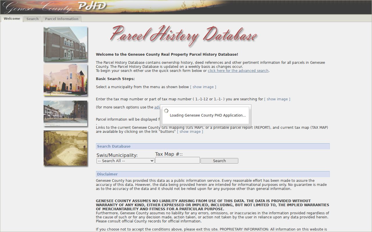
Keep the PID, tax map, legal description, and source date with each result instead of relying on a visual impression from the map alone.
Map Grand Blanc Township Neighbor Parcels
The immediate-block method is spatial first. It starts with a subject address in GIS, names the polygons sharing a boundary or facing it across the street, and then checks each PID in a separate record. The process is intentionally narrow. It does not make a claim about everyone on a street, a subdivision, or a mailing city.
- Find the subject address in Township GIS or Genesee Parcel History and record its PID, tax map, and legal description.
- Inspect the polygons that share a boundary or are directly across the street. Use road, drainage, common-area, subdivision, and municipal layers to test the relationship.
- Open each selected PID in BS&A or Parcel History and record the current owner/customer label and any deed reference separately.
- Use the Register of Deeds route for a dated ownership instrument when a current label needs a documented land-record context.
- For a full named-street records chain, use the Grand Blanc Township street directory instead of expanding a block lookup without a clear boundary.
Parcel polygon → PID and legal description → BS&A or Parcel History → recorded deed reference is the reliable process flow. A map has no documented public radius or adjacent-household export in the research, so it is better to inspect the relevant parcels one at a time.
Grand Blanc Township Neighbor Record Limits
After mapping the parcels, BS&A supplies a current property record. Its landing screen supports Address, Name, and Parcel Number modes. A detailed record can connect property, tax, building, sale, special-assessment, utility, and related categories. The detailed parcel screen may require an owner claim or paid access. The customer or owner field is valuable for a Grand Blanc Township neighbors search, but it is not a roster of people at an address.
Parcel History can supplement that result with owner history and deed references. The Register of Deeds can then provide recorded grantor and grantee parties. A grantor transfers a recorded interest, and a grantee receives it. Neither label establishes who occupied the parcel on a particular day. The right description is limited: a current parcel owner/customer, a recorded deed party, or a historical directory entry, each with its date.
For physical context, the Township Maps page links voting-precinct, cemetery, zoning, flood/wetland, and school-district maps. These maps help distinguish boundaries that overlap a short street segment.
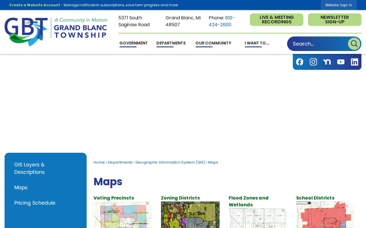
Aerial imagery from 1999, 2001, 2004, 2006, 2009, and 2018 can show physical change, but it does not identify a resident or prove title.
Grand Blanc Township Neighbors and Voter Records
Michigan voter records can support a limited registration question, not an all-neighbor map. A Qualified Voter File request can select one jurisdiction, district, school, village, or ward or precinct. A Grand Blanc Township request can therefore be scoped to the jurisdiction or a defined election geography. The request system does not create a map of every neighboring household.
The public record can carry a registration name, address, year of birth, registration date, status, voter ID, and selected history according to the request rules. License or state-ID number, month and day of birth, phone, email, signature, and other specified fields are withheld. An unregistered person, a household member without a registration record, or a protected address will not be reliably visible.
Use the Michigan Voter Information Center for official voter-information entry points and the state form for a permitted QVF request. A registration result should be dated and described only as a record of registration at the listed address, not as a claim of current household size or personal relationship.
Grand Blanc Township Neighborhood Planning Labels
The Township Master Plan describes approximately 80 neighborhood labels in a Nextdoor-based planning context. Most are residential subdivisions, and many have associations. That planning observation is useful for understanding a subdivision name seen on a plat, map, or directory entry. It is not an official current list of associations, officers, members, or addresses.
No official complete public Grand Blanc Township HOA roster was located in the research. A subdivision plat, Planning or Zoning record, Township FOIA request, or direct organization inquiry is the confirmation path for a specific identified association. Do not infer membership from a nearby parcel or from a social-media group. A neighborhood label gives geographic context, not a resident relationship.
Note: The absence of a public association roster is a privacy and custody limit, not a reason to assemble names from unrelated sources.
Grand Blanc Township Neighbors Community Contacts
The Grand Blanc Chamber Associations and Organizations directory provides a separate community layer. It lists public organizations and their contact categories. It does not identify who lives on a block, nor does it publish a complete HOA or membership roster. Use it for an organization contact or local-history lead, never as a substitute for parcel or household evidence.
| Public community listing | Appropriate use | What it does not establish |
|---|---|---|
| FISH of Grand Blanc | Public organizational contact and community context. | Membership or neighborhood residence. |
| Grand Blanc Little League | Public organization contact and historical community lead. | Participant or family address information. |
| Grand Blanc Optimist Club | Public civic-group contact. | A block-by-block roster. |
| Rotary Club of Grand Blanc | Public organization contact and local-history context. | Member residence or parcel ownership. |
The Chamber can be reached at 512 E. Grand Blanc Road, Grand Blanc, MI 48439, 810-695-4222, Monday through Friday from 9 to 5. Flint Public Library, the historical society, school yearbooks, and local publications can supply historical community clues, but an organizational contact remains different from personal address data.
The public Chamber directory presents organization categories and contact routes rather than a residents directory.
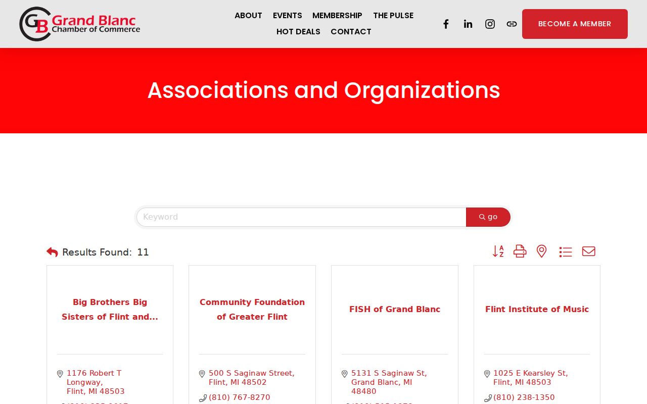
Use the category listing to reach an organization through its own public contact channel, not to make claims about the people connected to it.
Grand Blanc Township Neighbor Lookup Privacy Limits
Official records, library sources, and commercial neighbor-lookup products have different evidentiary value. Government sources identify a parcel, a recorded document, a registration record, or a public organization at a stated time. Commercial tools commonly combine public property, directory, historical-address, and marketing associations. That category can be stale or misidentified and is not an official parcel, voter, or deed source.
| Source category | Useful result | Boundary |
|---|---|---|
| Official property, GIS, and deed sources | Parcel facts, owner/customer labels, map relations, and recorded-party references. | They do not establish household relationships or all occupants. |
| Official voter records | Permitted, date-specific registration information. | They omit sensitive fields, unregistered people, and protected records. |
| Commercial neighbor categories | Potentially useful leads to verify with a custodian. | They can be stale, misidentified, and are not official proof. |
Utility, delivery, and DMV information are not public block records. Michigan's Address Confidentiality Program can provide a designated address for qualifying people at risk. Public records can therefore be incomplete by design. Michigan FOIA, MCL 15.231 et seq., seeks an existing nonexempt record and does not require an office to build a custom neighbor list.